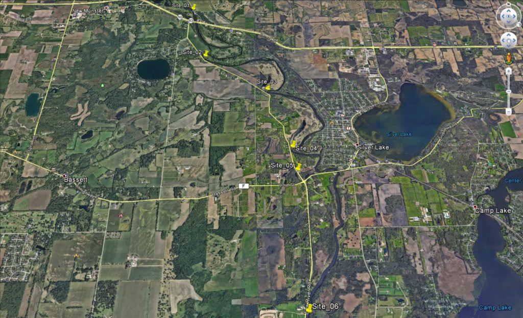
Project Overview
raSmith provided UAS services to Kenosha County along a five-mile stretch of the Fox River that runs adjacent to CTH W in the western half of the county.
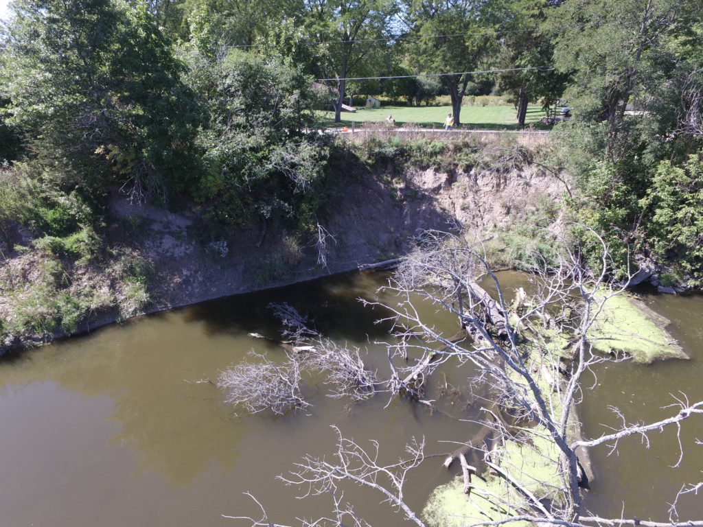
There were six different sites along this five-mile stretch where the Fox River directly abuts the highway, causing erosion concerns. raSmith utilized a UAS to conduct a series of low-level altitude flights at each of these sites, for the purposes of capturing aerial perspective imagery that showed existing riverbank conditions.
A series of exhibits were then prepared that graphically tied the UAS-derived images and a typical section to each geographic location. A preliminary riverbank rehabilitation prioritization chart was also created.
Kenosha County incorporated these exhibits into a grant application to help secure additional funding for the various riverbank rehabilitation projects.
Project Gallery