Did you know that, according to the Wisconsin Department of Natural Resources (WDNR), there are “5,289 miles of Class 1 trout streams in Wisconsin?” That’s a significant amount of trout stream waters that WDNR has classified as “high quality and having sufficient natural reproduction to sustain populations of wild trout, at or near carry capacity.”
While many Wisconsin trout streams have remained untouched, there are some streams that have been disturbed over the years for agricultural purposes and are now being restored. Because it is important to understand the original location of these streams before they can be reconstructed, WDNR works with a professional land surveyor such as raSmith to both identify the original location of the stream as well as stake the path for the reconstruction.
Our survey crews identify where the stream was originally located (typically referencing historical photos), measure the existing elevation at each end of the section of stream to be reconstructed, collect topographic data every 50 feet along the stream’s path using GPS, and provide construction staking to identify exactly where the new stream should be constructed to most closely match the stream’s original location.

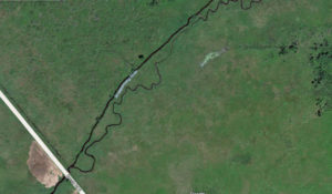
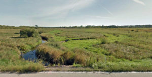
In order to identify where Scuppernog River was once located, and in an effort to restore this important trout stream, our land surveyors collected topographic data and measured existing stream elevations.
raSmith’s working partnership with the WDNR to restore Class 1 trout streams represents our organization’s commitment to the environment as a Wisconsin Department of Natural Resources Green Tier company.
About the Author

Eric Sturm is the director of survey services at raSmith. Eric has more than 30 years of experience in a wide range of land development surveying projects. He is responsible for project research and setup, calculations, plan review and quality control. He manages multiple projects including coordinating with the design engineers, field crews and drafting technicians and handles client communications. Eric plans and supervises survey tasks for the design and development of projects.
