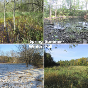
 As we begin to approach the end of the field season once again, raSmith would like to provide you with some thoughtful reminders about growing season wetland determinations/delineations and non-growing season wetland reconnaissance.
Growing Season Timing is Key
Wetland determinations/delineations must be completed during the growing season, which is typically mid-April to mid-October in Southeastern Wisconsin; however, the timing can vary slightly from year to year. In spring, we look for signs like emergence of herbaceous plants, emergence of flowers, and bud burst on trees to determine if the growing season has started.
In fall, we know the growing season has ended when woody deciduous species lose their leaves and/or the last herbaceous plants cease flowering and their leaves become dry and brown. This usually occurs after a hard frost. If you are planning a project and you believe wetlands may be present or you are unsure if they are present, it is imperative that you contact our wetland team right away to avoid lengthy delays to your project.
Remember: Wetlands and waterways are protected by law, so impacts to these features may require federal and/or state permit.
Non-Growing Season Alternatives
Although we cannot perform a formal wetland delineation during the non-growing season, we can perform a desktop review and a wetland reconnaissance of your project site to determine if wetlands are likely to be present. A wetland reconnaissance is a conservative field-based assessment completed during the non-growing season to ascertain the potential presence and general extent of wetlands and waterways on any given site or to confirm that these features are likely not present. This is typically done for preliminary planning purposes only until a formal delineation can be completed during the growing season. However, keep in mind that too much snow cover can limit our ability to conduct an effective wetland reconnaissance.
Locate Your Project’s Wetlands
Always check the Wisconsin Department of Natural Resource’s Surface Water Data Viewer (SWDV) if you are planning any project even if you think there are no wetlands on your property. Be sure to click on both the wetland and wetland indicators soils layers in the SWDV.
There are times when there are mapped indicators of wetlands but no wetlands are found. Determination of non-wetlands can be as important for your project as determination of wetlands—especially when there are mapped wetland indicator soils. This is important because, even if a stormwater permit is needed for a project, the WDNR will require, as part of the permit process, that the site is evaluated by a wetland ecologist to confirm no wetlands are present.
Contact Us
If you need a wetland delineation conducted on your property, please contact our ecologist, Erica Pergande, at erica.pergande@rasmith.com or (262) 317-3389.
