More than 200 municipalities in Wisconsin are required to have Municipal Storm Sewer System (MS4) permits in accordance with the Wisconsin Administrative Code. As part of this permit, certain water quality measures are required to help improve the quality of our nearby lakes and streams. If the municipality is located within a watershed area that has a Total Maximum Daily Load (TMDL) study completed, these pollutant reduction requirements are even more stringent.
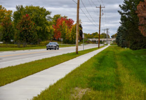 Every municipality is unique because they use different water quality facilities such as underground storage, permeable pavement, and green infrastructure measures to help achieve required pollutant reductions. Some communities consist of dense, urbanized areas that use curb and gutter roadway sections and storm sewer to convey stormwater runoff. Other communities are less urbanized and rely on wet ponds and infiltration basins. Roadside ditches, or a swale conveyance system, is another type of stormwater facility used to achieve a significant reduction of pollutants.
How effective are swales in pollutant reduction?
The question that everyone asks, especially when identifying how a municipality will achieve its TMDL goals, is how many pollutants are being removed by these swales? Most communities have already prepared a municipal-wide stormwater quality model. The most cost-efficient way to determine the effectiveness of swales is to use soil data provided by the National Resources Conservation Service (NRCS). As long as the swales meet Wisconsin Department of Natural Resources (WDNR) criteria, swales can be modeled using the soil types from NRCS to determine the infiltration rates provided in the WDNR’s technical standards. These rates can often be a conservative estimate in certain locations.
An accurate way to measure soil infiltration
As part of a community’s TMDL implementation plan, one option could be to reevaluate the effectiveness of municipal-owned swales. While this requires a larger effort than a brief desktop exercise, the results are more accurate for the model and may sometimes lead to higher infiltration rates than previously assumed. One way to determine the effectiveness of a swale and the infiltration rate of water into the soil is to perform a double-ring infiltrometer test.
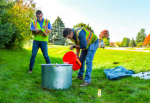
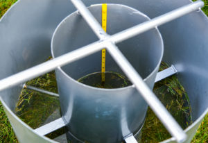
The infiltrometer features a stainless steel cylinder with two large open-ended concentric rings. Double-ring infiltration testing follows ASTM D3385 standards and can be modified slightly per the WDNR’s guidance. The test is generally conducted in these steps:
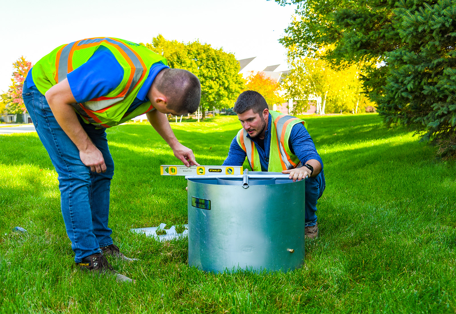
- Prepare a level testing area at the bottom elevation of the infiltration site.
- Set the rings two or more inches into the soil.
- Repeatedly fill the rings with water to maintain saturated ground conditions.
- Record measurements to determine how much the water level has dropped in the rings during a specific time period (a minimum of two hours).
Once the infiltration rate appears to level out and the two-hour mark is reached, the test can be concluded. The lowest infiltration rate observed is used for estimating the swale’s pollutant reduction and entered into a municipal-wide water quality model.
Infiltration testing is one of many tools that raSmith uses to help communities achieve TMDL goals and meet water quality requirements. The more accurate a community-wide stormwater quality model is, the better a community can plan and budget for future projects. Promoting infiltration and green infrastructure wherever possible is a step in the right direction to restoring the quality of our nearby waterways.
How can raSmith help with your next project?
Our water resource experts and municipal engineers develop innovative, tailored solutions that address clients’ needs and meet water quality requirements. We help communities maintain and improve their water and wastewater systems, parks and open spaces, transportation systems, structures, and public safety facilities.